


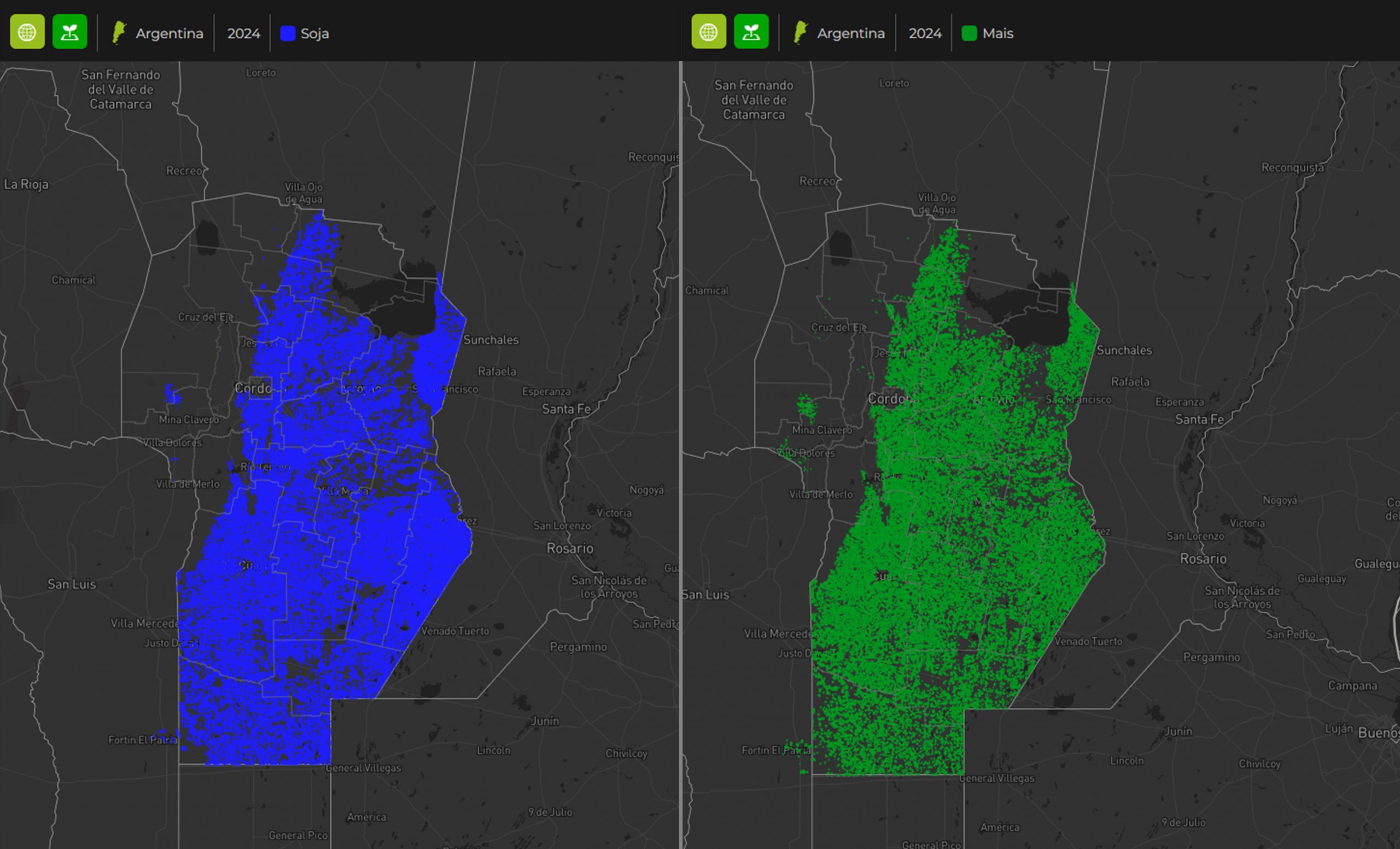
Argentina: High yields expected for maize and soyabeans. Maize acreage significantly expanded.
CropRadar from Kleffmann Digital RS has measured the areas under maize and soybean cultivation in Argentina by satellite.
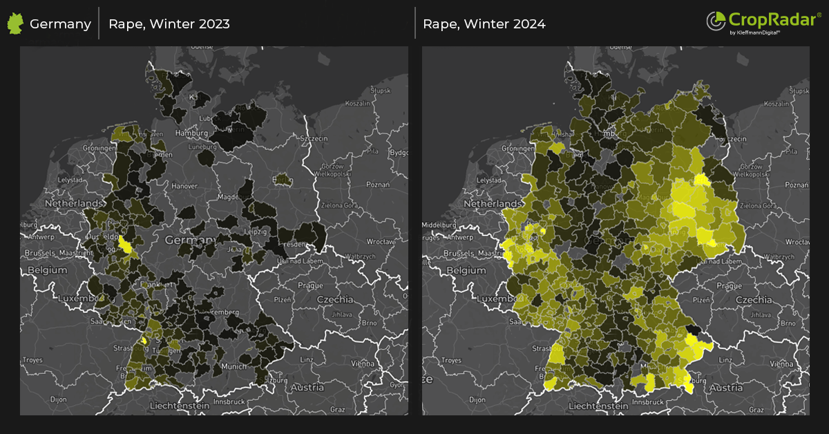
Rapeseed flowers significantly earlier than in 2023
Satellite monitoring shows vegetation in full swing. Moist soils coupled with high temperatures led to an early start of the rapeseed flowering this year.
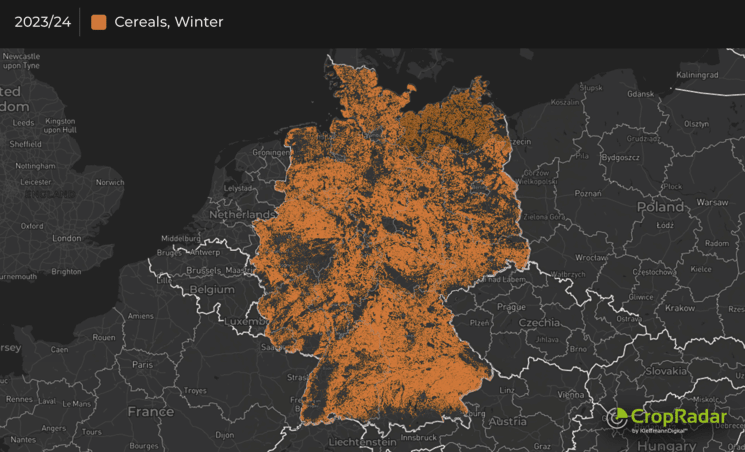
Significant decline in winter cereals acreage in Germany, down by over 6%
CropRadar has measured winter cereal acreage by satellite: With an area of 4,739,667 ha, winter cereal cultivation in Germany has fallen below the 5 million mark.


